 |
|
|
|
Welcome to the USCG AuxiliaryChart Updating Program
The Chart Updating program encourages the update of every NOAA Chart by any Auxiliarist at any time. There are no restrictions and any member can make Chart Updating reports to NOAA on any chart. “The Auxiliary may also help the National Oceanic and Atmospheric Administration (NOAA) and the United States Army Corps of Engineers (USACE) in updating nautical charts and publications.” (Excerpted from Chapter 2, Section B3 of the Auxiliary Manual.) A Memorandum of Understanding exists between NOAA and the U.S. Coast Guard Auxiliary. 1. The focus for the Auxiliary Chart Updating program is on prevention, accuracy, credibility, and professionalism, and is directed toward raising your competence in the eyes of NOAA. There are specific guidelines for taking fixes and depths that require pre-underway validation of all equipment that is used to perform measurements, and for reporting quality control evidence for each on-scene observation and instrument reading. Also required are explanations of the technique(s) used to acquire any reported data. Observers are directed to define each chart update task, list their on-scene observations, develop a conclusion from the collected evidence and make a final recommendation to NOAA. A fresh scientific approach is encouraged. Evidence can take the form of a fix taken with a GPS set using WAAS, depths corrected to the charted vertical datum, physical measurements, photographs, drawings, marked up chartlets, and printouts from the Internet. Any official document that supports your contention is great support evidence. The Internet can also supply great supporting data. In effect, you are pleading the case for acceptance of your premise as a chart update to NOAA. 2. Chart updating and operating tools are provided and are available for download. Chart Updating Promotional Tools: ▀ NS-CU01-Chart Updating Program Hand Out (Adobe). Print out and use this handout for promoting the Auxiliary’s Chart Updating Program with your members. Chart Updating Study Guides: ▀ NS-CU02-Chart Update Training Guide (Adobe) This guide is full of illustrations and photos of the various items that are commonly found on a Nautical Chart that have the potential for correction and update. Each listing has a short explanation about the type of problem that can occur and the specific things to look for that commonly go wrong. For newer members, there are tutorials on Nautical Charts and the use of a GPS Set. Also, there are guidelines for pre-underway checks, taking depths, fixes, photos, planning a patrol, and much more. In addition, an explanation of each field on the CU04-Chart Updating Worksheet is provided in the guide. Chart Updating Forms and Worksheets: ▀ NS-CU03-Chart Updating Form (EXCEL). This form is directed at Chart Updating and Coast Pilot correcting. The (locating or Fixing) LAT/LON fields and depth fields have been expanded to include the necessary quality control reporting requirements associated with these operations. Space is provided for a task statement, comments and observations, and a final recommendation to NOAA based on the evidence reported. Also, there is a place on this form for ordering a NOAA Nautical Chart. However, be sure to note the rules associated with ordering and receiving free charts. This form is temporarily available in EXCEL until it is programmed in Adobe and added to the National Forms Web Site. ▀ NS-CU03A-Chart Updating Form Field Explanations (Adobe) This is a brief explanation of each field on the CU03-Chart Updating Form. This document is temporarily available until it included on the NS-CU03-Chart Updating Form. ▀ NS-CU04-Chart Updating Worksheet (EXCEL) This worksheet is designed for managing the collection of your observations when multi-tasking chart updating activity is necessary, such as for marina surveys or composite sections of shoreline. Data fields are provided for the essential data for each planned observation. Prepare this worksheet on-line to enhance the professionalism of your final CU report. Explanation of each field can be found in the NS-CU02 Chart Updating Training Guide. This worksheet is temporarily available in EXCEL until it is programmed in Adobe and added to the National Forms Web Site. ▀ NS-CU05-Coast Pilot Text Correction Worksheet (EXCEL) Use this worksheet to organize updates and changes to the United States Coast Pilot. This worksheet helps pinpoint the page and paragraph of your changes for NOAA. The existing and new Coast Pilot copy are included as part of the report presentation. This worksheet should always be computer generated to enhance the professionalism of your final CU Update Report and is always sent to NOAA as an attachment to the NS-CU03-Chart Update Form. This worksheet is temporarily available in EXCEL until it is programmed in Adobe and added to the National Forms Web Site. ▀ NS-CU05A-Coast Pilot Text Correction Worksheet Field Explanations (Adobe) This is an explanation of each field on the CU05 – Coast Pilot Text Correction Worksheet. This document is temporarily available until it is included on the NS-CU05-Coast Pilot Text Correction Worksheet. Chart Updating Training Presentations and Hand-outs ▀ NS-CU06-Latitude-Longitude Minutes To Seconds Conversion Sheet (Adobe). Use this handout for the easy conversion of decimal minutes to seconds so that the chart updater can easily provide the correct LAT/LON expression on their reports. ▀ CU07-Vertical and Horizontal Error Calculator (EXCEL) This is an unique computer tool for making special calculations that help support your recommendations and improve NOAA’s confidence level in your reports. The following calculations can be performed with this unique tool. 1. LOCATION CALCULATOR – Used to determine the distance and bearing between two locations – Enter the assigned position and the observed fix for an object and you will get the distance in feet or nautical miles between the LAT/LONs plus the direction in True from the assigned position to the fix. 2. ALMANAC DATA Enter the MHW-Mean High Water reference for the area and enter the current Height of Tide. This information is used for other calculations on this document. 3. DEPTH CHECK CALCULATOR - Depth corrected for “correction for transducer” and the height of tide, and the difference from charted depth to corrected depth. 4. CLEARANCE GUAGE / VERTICAL CLEARANCE CALCULATOR - Computes the projected clearance using the height of tide and the vertical clearance. It also compares the result to any measured height input. 5. ESTIMATING THE HEIGHT OF AN OBJECT FROM A KNOWN DISTANCE - Using the distance to the object and the angle from the base (MHW) to the top of the structure, it estimates the height of the object. 6. CHARTIBILITY OF AN OBJECT - Use the length of the object and the scale of the chart and the system indicates whether or not an object is chartable on a NOAA Nautical Chart. ▀ NS-CU08a - Chart Update Form Training Example (Adobe) Use this example of the CU-Chart Update Form to demonstrate how a report should be prepared. (in the works) ▀ NS-CU08b - Chart Update Worksheet Training Example (Adobe) Use this example of the CU-Chart Update Worksheet to demonstrate how a report should be prepared. (In the works) ▀ NS-CU09 - Chart Updating Overview Training Presentation (PowerPoint) Enhance your chart updating learning experience by reviewing this presentation in conjunction with the CU02-Chart Updating Study Guide. This training presentation provides an overview of NOAA’s Chart Updating Program. Ask your SO-NS or ADSO-NS for information on scheduled Chart Updating workshops in your Division. ▀ NS-CU10-Chart Updating Training Presentation (PowerPoint) Enhance your chart updating learning experience by reviewing this presentation in conjunction with NS-CU02-Chart Updating Study Guide. This presentation is used as the basis for Chart Updating workshops. Ask your SO-NS or ADSO-NS for information on scheduled workshops in your Division. Background Study Material ▀ NS-CU11-GPS Waypoint Training Presentation (PowerPoint) This presentation provides an overview about the creation and use of Waypoints on a GPS. Use with your GPS’ Operating Manual. Understanding how waypoints are established is an important element in Chart Updating and patrol safety.▀ NS-CU12-GPS Routes Training Presentation (PowerPoint) This presentation provides an overview about the creation and use of Routes with a GPS. Use with your GPS’ Operating Manual. Understanding how to create Routes on a GPS is an essential skill for boating safety while on AtoN patrols. 4. If this Chart Updating Program interests you, talk to your FSO-NS or SO-NS. Each Division is urged to form a Chart Updating Team whose goal is to identify Chart Updating opportunities throughout their AOR and to establish a plan to perform the necessary observations and prepare the appropriate reports for submission to NOAA in order to correct the local charts. All of the
information that you need is available from this Chart Updating Web Page. Chart Updating is a year-round Auxiliary activity and you don’t need a boat to participate. New members are encouraged to join. All we want is your skill, knowledge, and your desire to make a contribution. Plan to attend a CU Workshop soon.
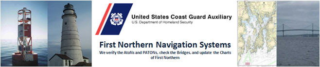
There are multiple chart updating opportunities on this picture. However, you won’t be able to notice them without proper CU training. Plan to attend a CU Workshop and open the door to a new navigation experience and education. If every Auxiliary Operational Facility included one chart updating mission on each of their scheduled patrols this year, we would make a large dent in the list of needed chart corrections on your area NOAA charts. There may be over 3 million chart updating opportunities out there at this moment. ONLINE 7030 - Click here to fill out your mission hour form to receive credit for your ATON work in AUXData use mission category 41 and submit to your FSO-IS
|
|
Questions or problems regarding this web site should be
directed to
Webmaster
|